Thursday, November 8, 2018

Part 7 - Sabino Canyon.

Part 7 - Sabino Canyon. 

We had heard great things about this place, and even watched a few Youtube videos about different hikes here. So, while still staying on the West side of town, we took the 50 minute drive to the Sabino Canyon recreation area. 

Our first hike was on the Nature Trail Loop near the Visitors Center. The trail was basically a loop through the flat desert lowlands with beautiful views of the Catalina Mountains. Markers along the trail acted as name tags for the different flora of the Sonoran Desert. 

The most rare of Saguaro Cacti can be seen here, it is a Crested Saguaro, and only 25 exist within the boundaries of the Saguaro National Park. 

Here is our picture of the Crested Saguaro at Sabino Canyon.


One of the most unique features about this area are the Trams that operate in both Sabino Canyon and neighboring Bear Canyon.  The Sabino Canyon Tram is a 3.8 mile narrated tour which allows visitors to get off the tram at any of the 9 drop off points and re-board for a ride back to the Visitors Center. The Bear Canyon Tram is a 2 mile ride that provides access to the trail head for Seven Falls.

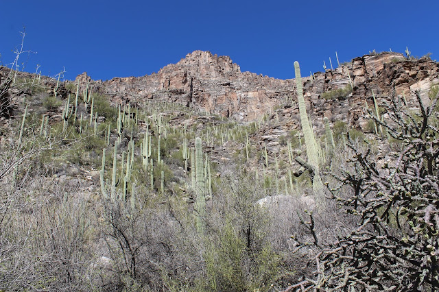
Below is a picture from an overlook on the Sabino Canyon Trail. The road for the tram can be seen near the center of the picture and the small trail on the top left is the Phoneline trail.

The Bear Canyon tram is a great way to shave a couple of miles off of the hike back to Seven Falls. It is always a good thing to see water in the desert, and this trail follows a fairly active creek that leads you back to its source at the falls.


There are several creek crossings on the Bear Canyon Trail, and fording the creek and moving upstream takes you further into the canyons steep walled depths.


The trail keeps climbing, and eventually rises far above the creek, not descending until you reach the first of the 7 falls. If you look closely at this picture you can see people standing around the several pools formed by the falls.


We were surprised to find these lovebirds when we got to the largest pool at Seven Falls.


If you are in the Tucson area to do some hiking, you will regret not taking some time to explore the trails in Sabino Canyon Recreation Area.

If you want to read more about our adventures in Tucson, you can catch up on the previous entry here:

Part 6 - West Side

Here is the link to our next article.

Part 8 - Cactus Country RV Park Review.


Part 6 - West Side.

Part 6 - West Side


Not trying to start a gang war here, but the West Side is the Best Side. To be fair, it's all we knew of Tucson so far, so we didn't have much of a comparison. 

From our home base on the West side of town we had direct access to Tucson Mountain Park, but a short drive North on Kinney Road would take us to Saguaro National Park West. Our RV park turned out to be a great location to explore the Tucson Mountains.

One thing we recommend doing, if you are going to spend time hiking in Tucson, is to purchase the Interagency Annual Pass from the Red Hills Visitor Center for $80. This can be used at Mt Lemmon, Saguaro National Park, and Sabino Canyon Recreation Area. So our first drive into the park was to get this pass and check out a couple of the shorter trails.


Our first stop was the Desert Discovery Nature Trail just past the Visitor Center on Kinney Rd. It is a handicap accessible, loop style trail, that is a great introduction into the Sonoran Desert flora.

Here is a great pic of a Saguaro Skeleton. The vertical wooden support system for the Saguaro are called "ribs", and during rainy periods, they allow the cacti to expand to store water for dry seasons.


Continuing our journey, we made our way to Signal Hill to take the short hike up to see the ancient petroglyphs etched into the rock. Warning: Signal Hill is accessed by a dirt road on the Bajada Loop.  It is very rutted,prone to erosion, and best traveled by vehicles with a high clearance.

Here are some of the petroglyphs we found on Signal Hill:


The highest peak in the Tucson Mountains is Wasson Peak, and it is accessible by a few different trails.  For our first long hike into the Tucson Mountians, we chose to try the Hugh Norris Trail. Access to this trail is down another rough dirt road on the Bajada Loop.

The Hugh Norris Trail has a very steep ascent.


 Not too long into the hike, you are immediately rewarded with breathtaking views of the desert below you.


We only made it as far as the saddle where Hugh Norris Trail Crosses the Sendero Esperanza Trail. Unless we wanted to hike down in the dark, we had to turn around now. So, we came back another day, and conquered the peak from the King Canyon Trail Head.

Here are a few pics from that route:


Ever wonder what an Arizona Canyon Trail looks like, here ya go:


This is a beautiful Purple Fish Hook Barrel Cactus that we saw on our way up.


What looks like a dirt road in the background is actually the trail we took to the top:


Wasson Peak at 4,687 feet.


We loved hiking to Wasson Peak so much that we took a 3rd trail, the Sendero Esperanza, to the saddle where it meets with the Hugh Norris Trail. This allowed us to pick up where we left off on the Hugh Norris Trail and finish out our failed peak attempt from our first hike.

Here are a few shots from the Ez-Kim-In-Zin picnic area at the bottom of the Sendero Esperanza Trail. This was one of our favorite places to spend time relaxing on days in between hikes. Dogs aren't allowed on the trail, but we loved this picnic area so much, we took them just to make sure they didn't miss out on the amazing mountain views.


A view out the window of one of the shelters at the picnic area:


The distant dome at the top of this picture is Wasson Peak, and you can see the trail winding around the right side to get to the top.


Here is a view from further up the trail to Wasson Peak. The white dots you can see on the left are part of the city of Tucson in the distance.


So many things to love about Arizona, but hiking had become our new favorite. We had never experienced a feeling of victory quite as satisfying as getting out in the wilderness and conquering a mountain peak. We knew we were hooked, and that this was only the beginning.

Stay tuned for more of our adventures in the Tucson area.

Until then, here is a link to our last blog article:

Part 5 - Mt Lemmon

Here is the link for our next article:

Part 7 - Sabino Canyon


Wednesday, October 31, 2018

Part 5 - Mount Lemmon

Part 5 - Mount Lemmon.

Warning: Not for drivers (or passengers) who are scared of heights.

Catalina Highway can be seen winding through the valley at the bottom of this picture and up the mountain on the top left. 


We had been recommended by friends to take a drive up to the top of Mt Lemmon in the Santa Catalina mountains. So we squeezed this in on one of my few free days, right before starting my new job. Mt Lemmon is best accessed via Catalina Highway, a 27 mile stretch of road that winds through the mountains up to the peak. There are many pull overs with scenic vistas, trail-head parking, and camping areas.


Mt Lemmon is named after Sara Allen Plummer-Lemmon, who in 1881, was the first white woman to make it to the peak.  It classified as a "Sky Island", which is defined as a isolated mountain surrounded by a drastically different lowland environment.  Tucson has several sky islands surrounding the city, which is why it is such a great destination for outdoor enthusiasts.


The coolest thing about this drive is the biological diversity you get to see. After leaving the Lower Sonoran Desert Zone at the bottom, you pass through the Upper Sonoran Desert Zone, and start to see the Saguaro cacti thin out. The next zone is the Transition Zone, and is characterized by Oak trees and Ponderosa Pines. The Canadian zone contains Fir Forests, and then you end up in an aspen forest at the top of the drive.

Starting from the bottom, the first vista point is the Babad Do'ag Vista. The vista isn't that impressive in the daytime, but it is very popular at night for its views of the Tucson city lights below.  Next up is the Molino Canyon Vista where seasonal water can sometimes be found in the canyon. Further up the road is the Molino Basin Campground, where the Arizona Nationa Scenic Trail crosses from Redington Pass, and up into the Catalinas.

The picture below is the Molino Canyon Overlook: A Shin Dagger Agave in the foreground, with Catalina Highway in the Background.


More Molino Canyon Vista.

A strange bit of history here, is the fact that prison labor was used to construct the Catalina Highway. In 1939, the U.S. Bureau of Prisons authorized the camp and it was expanded in 1940. The Japanese Americans interned at the 'Honor Camp' on Mt Lemmon were conscientious objectors to the war and were given a less strict captive environment than their peers.  The former site of the prison camp is now called Gordon Hirabayashi Recreation Area, it is just up the road from Molino Basin, and is named in honor of one of its outspoken prisoners.

Its almost like there is something from this shameful, xenophobic part of our past that we could learn from...Trump...we are looking at you. Here is a link which goes into more detail about that sad, but interesting part of our history. 

Website: The Gordon Hirabayashi Story

Somewhere near the 5000 ft elevation mark, you will come to the Thimble Peak Vista. We pulled over here by accident, not knowing how big of a landmark Thimble Peak is. We can see it from our RV park at Cactus Country.

Thimble Peak Vista...The small dome on the ridge-line behind Scott's head is Thimble Peak. 

In hindsight, we really should have taken more pictures, but the narrow road and steep drops had Jenny feeling kinda queasy. NO WAY was I trying to take pictures while driving here either.

Our next favorite vista point on the way up is EVERYONES favorite, and despite the many parking spots, its usually so busy that parking is difficult to impossible. The reason its so popular? The views. There is a long, flat, outcropping of rock that overlooks the Sabino Canyon area, and many people picnic out there or just get out of the car to play on the rocks.  Rock climbers are often seen practicing here. We have also seen rescue teams running drills and fake rescues.

A little farther up the road is the entrance for Rose Canyon Lake. There is an entry fee, so we kept driving. To my understanding it is a very nice lake for fishing and has a campground. Here is a  link to the U.S. Forest Service page for Rose Canyon Lake

Website: U.S. Forest Service, Rose Canyon Lake


Getting closer to the top of Mt Lemmon. The Loma Linda picnic area is probably the best one on the mountain. The views are incredible, and we actually did grill out up here once with friends from my job at the hospital.

Loma Linda picnic area. 

Just around the bend from Loma Linda, there is an intersection with the unpaved fire road that goes down the North slope to the town of Oracle. This is known as the back way up Mt Lemmon and requires a high clearance 4x4 vehicle. Staying on the paved road brings you to another intersection. Staying right leads you to the summit, and veering left will take you into the town of Summerhaven.

Summerhaven is a small cluster of houses and businesses near the summit of Mt Lemmon. The temperatures are generally 30 degrees cooler than the valley below, and it is a great place to hike or relax in the hot Summer months. You can AirBnB a cabin for the weekend up here. There is one restaurant in town called the Sawmill Run. We ate there once and the food was only OK. There is a general store to keep you from driving 27 miles down the mountain for beer. The jewel of Summerhaven tho has got to be the Cookie Cabin. Don't let the name fool you...they also sell delicious pizza by the slice. Here is their website if you need to plan your cookie/pizza order before your visit.

Website: Cookie Cabin on Mt Lemmon

Back on Catalina Highway, heading uphill, you will come to what looks like a ski-lift. Can you have a ski-slope this close to Mexico? Yes you can. Mt Lemmon is the Southernmost ski-slope in the U.S. There is another restaurant here, called the Iron Door...but the sheer amounts of people we run into every time we drive by, has kept us from ever trying to eat there. Climbing another bend, the highway passes the parking area for the top of the ski slope, and continues to the observatory and parking at the top.

(Below) About as close as you can get to the top of Mt Lemmon from the road. 
The top of the ski lift is right in front of us in this picture.


If you only do one thing while in Tucson on a short trip, we recommend taking the drive up to the top of Mt Lemmon.

Thanks for reading!

Here is a link to our previous article:

Part 4 - Desert Trails RV Park Review

Here is a link to our next article:

Part 6 - West Side


Tuesday, October 30, 2018

Part 4 - Desert Trails RV Park Review.

Part 4 - Desert Trails RV Park.

Desert Trails RV Park
3551 San Joaquin Rd
Tucson, AZ. 85735
(520) 883-8340


The first thing you should know about this place...they sure don't like to answer their phone. The message on the machine assured campers they would be able to get a spot if arriving before busy season in December. Their voicemail seemed to infer that they did not want to be bothered with any phone calls about off season bookings. Online, the park looked beautiful and was full of well-manicured landscaping. In real life, with no guide to your spot, the parks landscaping made it very difficult to maneuver large rigs through.


We found an open 50 amp spot that we could back the camper into, and we were happy to be home. 

Our home for two months. 

Pros: The best things about this park are the mountain views and the hiking trails that lead into Tucson Mountain Park.  The Tucson Mountains are right in your backyard but you also have great views of the Santa Ritas, the Santa Catalinas, and the Baboquivari Mountains. The trails here offer a true Sonoran Desert hiking experience with Saguaro Cactus, dry desert washes, and Palo Verde trees.  We really enjoyed the hikes and bike rides on the desert trails as well as the swimming pool and the billiards hall. Food truck visits twice a week and occasional concerts on site were also nice. We did meet a few good people who were traveling through the area and stayed in touch with some after we left.


Inca Kola from one of the food trucks


This was the view from the, "observation tower", which was just the rickety platform from one of the previous park's old water slides.


Luna hanging out on the viewing deck. 


Part of the old water park.


I thought this was a dog training area, turns out it was for mountain bikes. 


Cons: Worst things about the park...there were many...Here goes. All sites are not created equal, and ours was not big enough to park our tow vehicle on. Parking situations changed on the daily and we were constantly bothered by workers knocking on our door with instructions on where to move my truck that day. It came to a head on Christmas Eve when I came home from work and parked outside the camper on the roadside just long enough to change clothes and take Jenny out for dinner. Wasn't there ten minutes and staff was knocking on my door to tell me to move the truck.  Funny, since the office was closed...someone had a direct phone number to the owner...and we couldn't even get them to answer the phone to book a site.


 More Cons: Which leads me to the next problem with this RV park, the snow birds who were returning customers. They flock together like a high school clique and are not friendly to new-comers. In fact, the people across from us had enough room to park 10 cars and were outside on Christmas Eve watching as we left for dinner. I wonder who called the office on us?  The owner has terrible people skills, a snide British accent, and is rude to your face with no apology. Oh yeah, and his name is freakin' Pericles, so of course he is a douche. Final Thoughts: If you don't mind feeling like an outsider in your own home away from home, while you are spending good money to be there, this place would be a good choice for you. While this is a great location to explore the West side of town, it is very far from any amenities like grocery stores or other supplies.


Female snowbird species


Alpha male snowbird species

The last straw for us was when we were told by the office that we had to leave January 1st to clear out the site for more snowbirds who had somehow booked a site when the office never answers their phone. Another case of someone having a secret phone number to the owner? After all of the interruptions of our privacy and inconveniences with parking, we were totally ready to move on to greener desert pastures.

Fun Activity: Call this Limey (don't worry they wont answer anyway) and listen to the voicemail. Desert Trails RV Park: 520-883-8340


If you are reading our blog for the first time, here is a link to our first article. 


Link to the previous article:

Part 3 - Starizona

Here is a link to the next article:

Part 5 - Mt Lemmon


Thursday, October 25, 2018

Part 3 - Star-i-zona.


Part 3 - Star-i-zona.


Before we even reached the Eastern boundary of the Tucson city limits we began to see the Saguaro Cactus rising high above the desert floor with a backdrop of several mountain ranges that surround the city. After dodging impatient drivers all the way across town, we finally made it to our destination. Desert Trails RV Park on the West Side of Tucson. This place used to be a water park and here is a view from the top of what used to be a water slide.


Bugzy was happy to be out of the truck and back in his home on wheels.


Our new home bordered Tucson Mountain Park, and was accessible by several trails leaving our park.
We were brave enough to go explore the trails the first night, once it had cooled down. The stars were like nothing we had ever seen, and later on, we found out that Arizona had a pretty fitting nickname.
Star-i-zona!!!

There were some great things about this location. You can leave the park on your bike and ride through the Sonoran desert on miles of trails. The trails were marked by painted rocks that pointed you back to the RV parks and neighborhoods where the trails began.

Jenny was actually happy to have found a Tarantula out on the trails at Tucson Mountain Park. She didn't get too close to take this picture though.


We learned a lot about the local plants while we were here, thanks to several plaques marking the different species. Trees and shrubbery such as Paloverde, Creosote, Ironwood, and Mesquite had become familiar to us.

We also got to know the differences between Cholla, Staghorn, and Saguaro cacti as well as which parts were edible. Tucson mountain park was amazing, and we took lots of pictures.


I don't think this was a real grave, but who knows. 


Someone spent lots of time putting the rocks into this trippy spiral pattern. Was Jim Morrison here?


Here is a Scott imitating the many Saguaro that loomed over the desert trails.


One of our favorite places in Tucson Mountain park was the Ironwood Picnic area. You could reach it from the trails that left our RV park. It was named after the giant Ironwood tree that shaded the last of many picnic areas that edged up to the road through the park.


 Here is Luna enjoying some of that shade from her picnic table perch.


We took a drive through scenic Gates Pass the day before Scott's job started. Beautiful sunset views from up there.


The Sonoran Desert was an amazing place that we instantly fell in love with. The mountains surrounding the Tucson area were a beautiful backdrop, but we wanted to explore them further. Stay tuned for our review of Desert Trails RV Park and some of our mountain adventures.

If you just came across our blog, here is a link to our previous article.

Part 2 - Road Trip!!!

Here is a link to the next article, a review of Desert Trails RV Park:

Part 4 - Desert Trails RV Park